Презентація на тему:
Lena River
Завантажити презентацію
Lena River
Завантажити презентаціюПрезентація по слайдам:
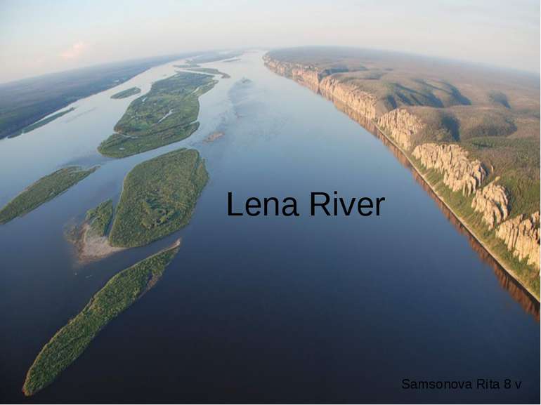
The Lena is the easternmost of the three great Siberian rivers that flow into the Arctic Ocean (the other two being the Ob River and the Yenisei River). And it is the largest river in Siberia and the longest river in the Russian Federation.
It is the 11th longest river in the world and has the 9th largest watershed. It is the greatest Russian river with its watershed entirely within national ranges. length = 4,472 km (2,734 mi) elevation = 1,640 m (5,381 ft) watershed = 2,500,000 km² (965,250 mi²) The river rises in the western slopes of the Baikal Range 12 km west of Lake Baikal. At its mouth into the Laptev Sea in northern Siberia, the river forms a huge delta, which is the largest Arctic delta, and the most extensive protected wilderness area in Russia. delta = 32,000
History The river around 1890 In 1620-1623 Russians under the leadership of Demid Pyanda sailed up Lower Tunguska, discovered the proximity of Lena. In 1623 Pyanda explored some 2400 kilometers of the river from its upper rocky part to its wide flow in the central Yakutia. In 1628 Vasily Bugor and ten men reached the Lena, collected yasak from the natives and founded Kirinsk in 1632. In 1631 the voyevoda of Yeniseisk sent Pyotr Beketov and twenty men to found an ostrog at Yakutsk (founded in 1632). From Yakutsk other expeditions spread out to the south and east. The Lena delta was reached in 1633.
The Lena river is an important waterway and navigable for almost all its length beginning with the village of Kachuga. The port of Tiksi on the Arctic Ocean is connected to the Upper Lena rail network via the station at Osetrovo, another Lena river port. Yakutsk, Olekminsk, Lensk, Kirensk, and Osetrovo are the biggest ports on the navigable river section.
Freeze-up in the Upper Lena begins in the middle of October, and in early November in the Lower Lena. Autumn drifting of the ice lasts up to 20 days; the greatest ice thickness (up to 3 m) is in the north (downstream); in the upper Lena it reaches 50 cm.
When the ice on the Lena River melts before the ice downstream does, which usually causes flooding because ice blocks hinder the flow of water. In 2007, the river over-flooded and more than 1,000 houses and 12 towns were under water.
The wet tundra in the delta, which floods each spring, is an important area for nesting and migrating birds, and also supports a rich fish population. There are 92 planktonic species, 57 benthic species, and 38 species of fish in the river. Sturgeon, burbot, chum salmon, Coregonus autumnalis, Stenodus leucychthis.
The majority of researchers believe that the name of the river Lena has been acquired from the original Even-Evenk name Elyu-Ene, which means "the Large River".
Vladimir Ilyich Ulyanov took his alias, Lenin, from the river Lena, possibly because he was exiled to the Central Siberian Plateau.
Схожі презентації
Категорії


